

Map of Metro Manila
The Pearl of the Orient There is no other major Asian city that compares to the relaxed atmosphere you will find here, where live music is to be enjoyed, where having fun is a way of life.
Known as the Pearl of the Orient, Manila missed the train as far as Dragon cities are concerned, preferring to keep it’s soul, rather than being over developed and heartless.
Yes, shocking 3rd world poverty is obvious as you move around the metropolis, but the people are never slow to smile.
Yes, shocking 3rd world poverty is obvious as you move around the metropolis, but the people are never slow to smile.
Metro Manila grew around the original native settlement of Maynila after the Spanish arrived and built Intramuros (walled town).
The Metro area consists of - Manila, Quezon City, Pateros, Caloocan, Las Pinas, Makati, Malabon, Madaluyong, Marikina, Muntilupa, Navotas, Paranaque, Pasay,Pasig, San Juan, Taguig and Valenzueala. Quezon City, is named after the former Philippine President Manuel L. Quezon who founded the city in 1948 to replace Manila as the country’s capital. As such it is home to several government offices, and Universities. Centers of business and finance are Makati, Fort Bonifacio Global City, Manila City, and Ortigas Center.
The oldest Chinatown in the world is located north of Intramuros, just over the Pasig River.
The oldest Chinatown in the world is located north of Intramuros, just over the Pasig River.
In Ming Dynasty the flourishing Kingdom of Maynila traded with China. Tondo, on the banks of the Pasig River, was the capital.
Manila was founded on 24th June 1571 by the conquistadors Martin de Goiti, Juan de Lacedo, and Miguel Lopez de Legaspi. In 1867 the Spanish Government of the Philippines created the Province of Manila, with Intramuros as the Capital.
During the 7 Year’s War, the British occupied Manila from 1762-64, when it was handed back to Spain, and in 1898 Spain ceded the Philippines to the United States after the Treaty of Paris ended the Spanish-American War.
Manila developed south during the American era, along Taft Avenue, where you can see the occasional surviving colonial architecture. This also developed slowly westward on re-claimed land, up to - and beyond Roxas Boulevard.
In 1948 Quezon City replaced Manila as the country’s. It is home to several government offices, and Universities.
The National Capital Region (NCR), formed in 1975 under the Metro Mania Development Authority, is composed of the 16 cities - Manila, Caloocan, Las Pinas, Makati, Malabon, Mandaluyong, Marakina, Muntilupa, Novatas, Pasay, Pasig, Paranaque, Quezon City, San Juan, Taguig, Valenzuela, plus the Municipality of Pateros
Centers of business and finance are Makati, Fort Bonifacio Global City, Manila City, and Ortigas Center. The oldest Chinatown in the world is located north of Intramuros, just over the Pasig River.
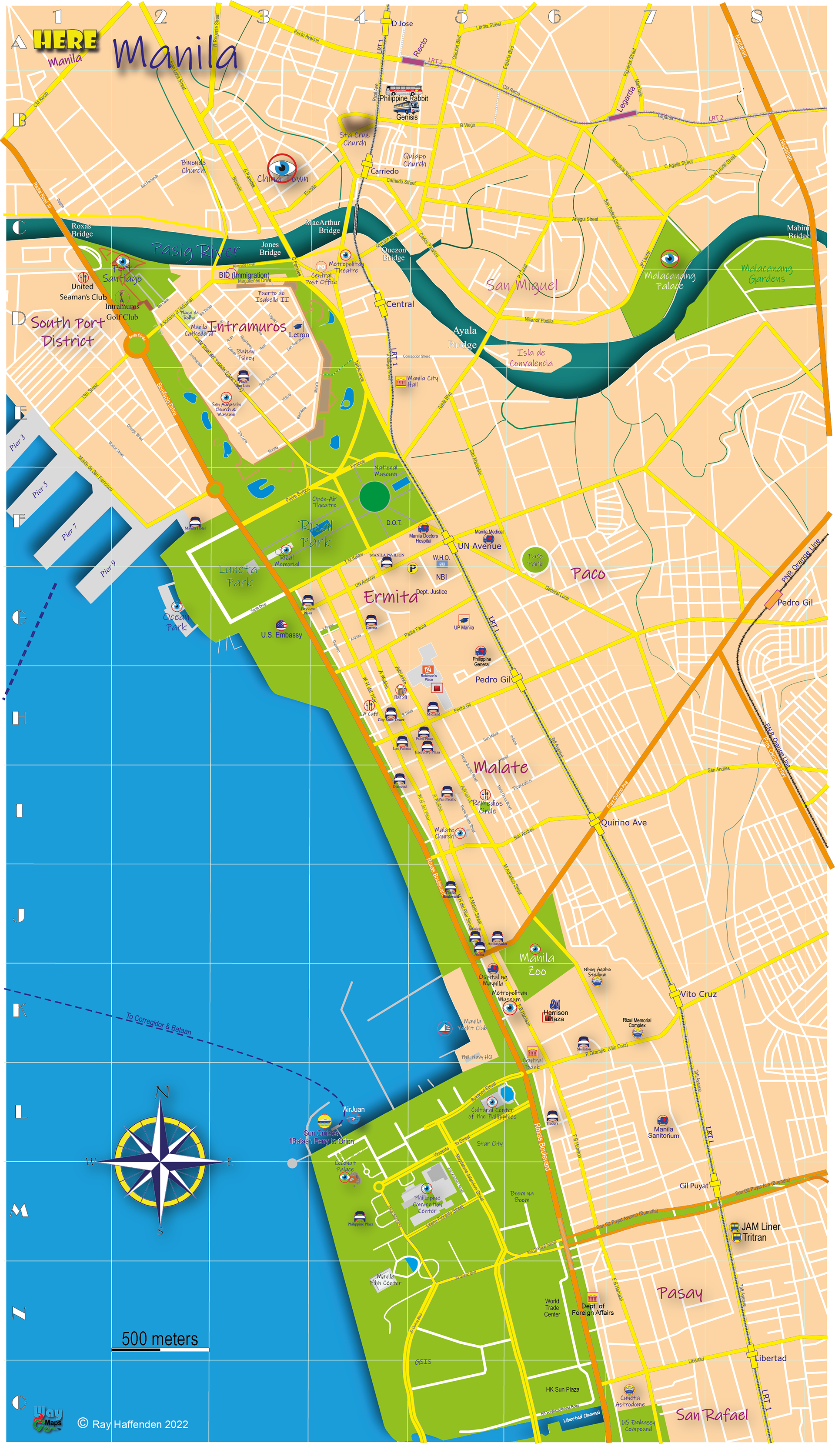
Map of Manila
Manila - Tourist Belt When in 1571 Spanish conquistador Miguel Lopez de Legazpi founded Manila on the bank of the Pasig River, in what today is Intramuros (within the walls). Manila grew around these walls, starting with the Chinese traders just across the Pasig River - today’s China Town.
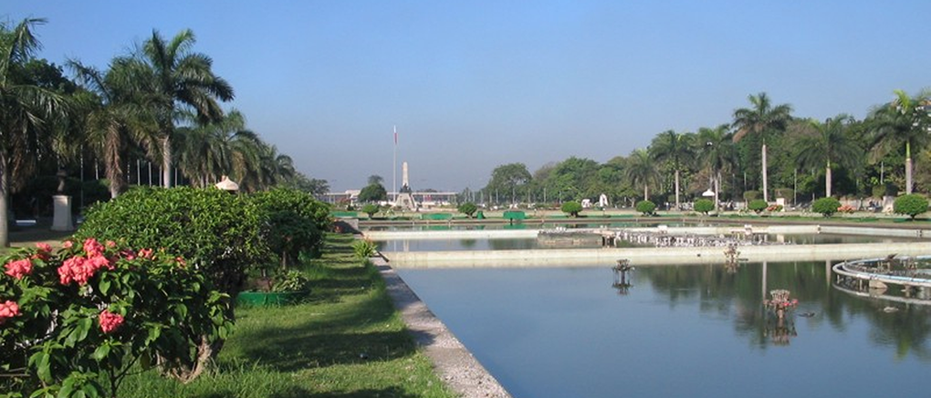
To the South Luneta and Rizal Park add the greenery, and just up the river they built the Presidential Malacanang Palace.
Manila has always been a haven in the Far East, and renowned for its dining and entertainment - live music, lively discos, watering holes, night life, shopping - Manila has it all.
The Bavarian restaurant “Munchen“ is still a popular dining and meeting place, and their daily lunch and dinner specials are the best value in Ermita.
The Historic Malate Church was for a while a billet for the British Forces during their brief occupation of the city 1762–63.
The Historic Malate Church was for a while a billet for the British Forces during their brief occupation of the city 1762–63.
Cultural Center of the Philippines sits on reclaimed land next to the Manila Yacht Club, and is home to the Philippine Convention Center.
Makati - Business District The financial center of the Philippines, has the highest concentration of multinational and local corporations in the country.
Major banks, corporations, department stores as well as foreign embassies are based in Makati. The biggest trading floor of the Philippine Stock Exchange Philippine Stock is situated along the city's Ayala Avenue.
In 1851, Don José Bonifacio Roxas, (related to the Zobel de Ayala’s) purchased the Jesuit estate of "Hacienda de San Pedro de Macati" for 52,800 pesos, and in 1901, the Americans declared the whole area south of the Pasig River a US military reservation, establishing Fort McKinley (now Fort Bonifacio).
In the 1930s, the first Manila airport – Nielsen Field opened and whose runways can be traced by what is now Makati & Ayala Avenues. Following WW2 the Ayala Corporation started developing “Little America” into the business center, shopping and entertainment area of P Burgos that we know & love!
In the 1930s, the first Manila airport – Nielsen Field opened and whose runways can be traced by what is now Makati & Ayala Avenues. Following WW2 the Ayala Corporation started developing “Little America” into the business center, shopping and entertainment area of P Burgos that we know & love!

Map of Makati

Map of Ortigas Center
Ortigas Center financial and business district is Manila’s 2nd most important business district after Makati, but the 1st for shopping!
Home to SM Megamall, the 3rd largest shopping mall in the world, the bar & restaurant area of St. Francis Square, the Asian Development Bank, Shangri-la EDSA hotel, San Miguel Corporation, HSBC Philippines, Jollibee, Robinson’s Galleria. The EDSA Shrine, Wack-wack Golf Club, The Podium, & Shangri-la Plaza.
For bargain basement computer peripherals, and designer label goods, Greenhills Shopping Center is the place to head!
Cubao - Home to the Araneta Coliseum, the Philippines favoured venue for the P.B.A. (Philippine Basketball Association) and other major events, and a great place to catch a bargain in and around the malls,
Most of the bus lines heading north have their main terminals here (as well as JAM - heading south to Batangas) including -
Victory Liner, Partas, Five Star, Philippine Rabbit, Viron, Dagupan, Times, Dominion, Viron, & Baliwag
Because of it's location on both LRT2 & MRT3 lines on EDSA and close to the end of the Northern Luzon Expressway (NLEX) it makes it the quickest way avoiding Manila's legendary traffic into, and out of, Manila.

Map of Cubao

Map of NAIA
Manila Airport There are 4 terminals connected by a shuttle bus, which runs every 15 minutes, connecting terminals for passengers with ongoing connections from a different terminal. Philippine Airlines has it's own service between Terminals 2 and 3.
It is a requirement to clear customs and immigration, as the service runs on roads outside the airport so allow for horrendous traffic!
It is a requirement to clear customs and immigration, as the service runs on roads outside the airport so allow for horrendous traffic!
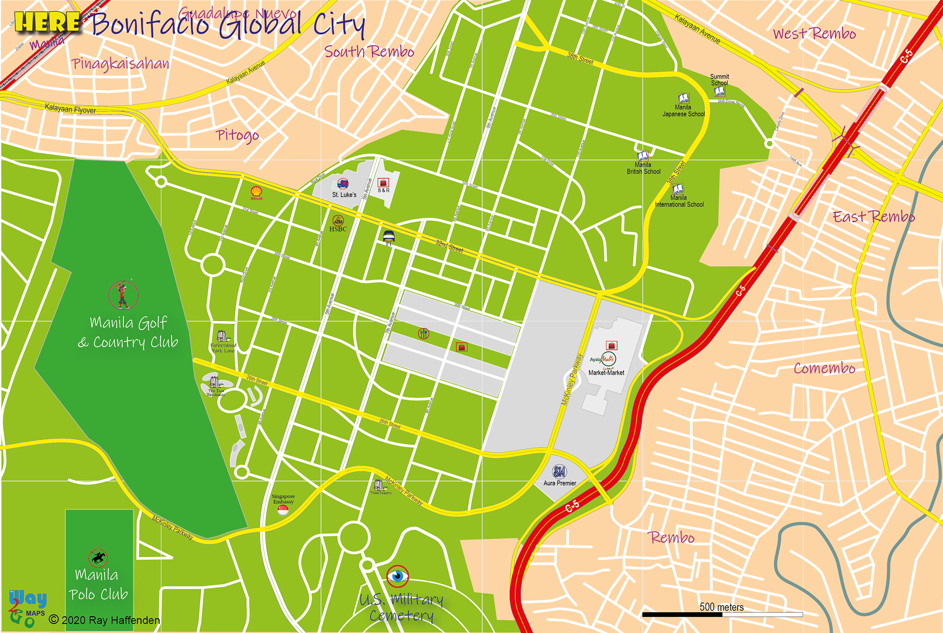
Map of BGC
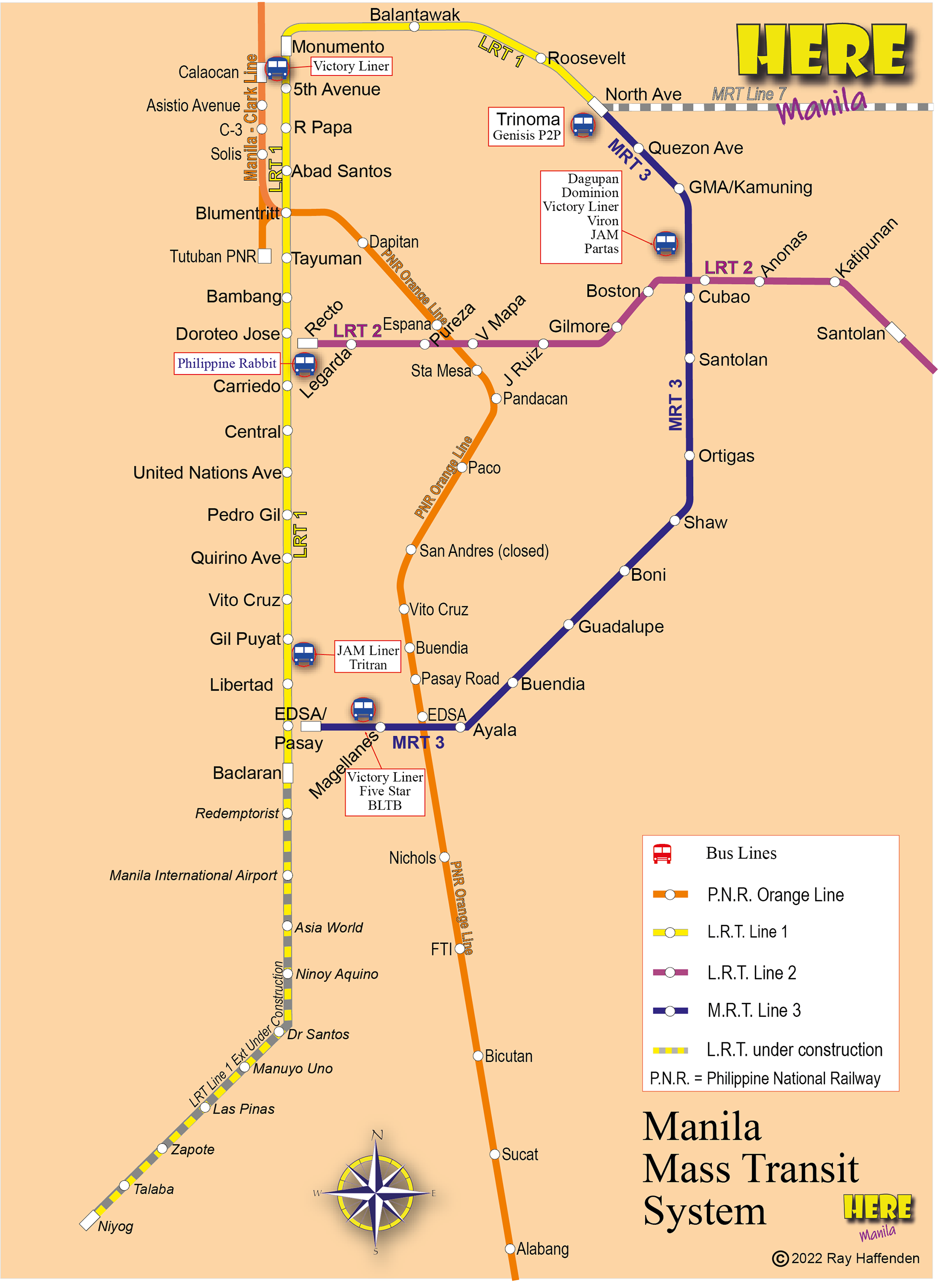
MRT Map
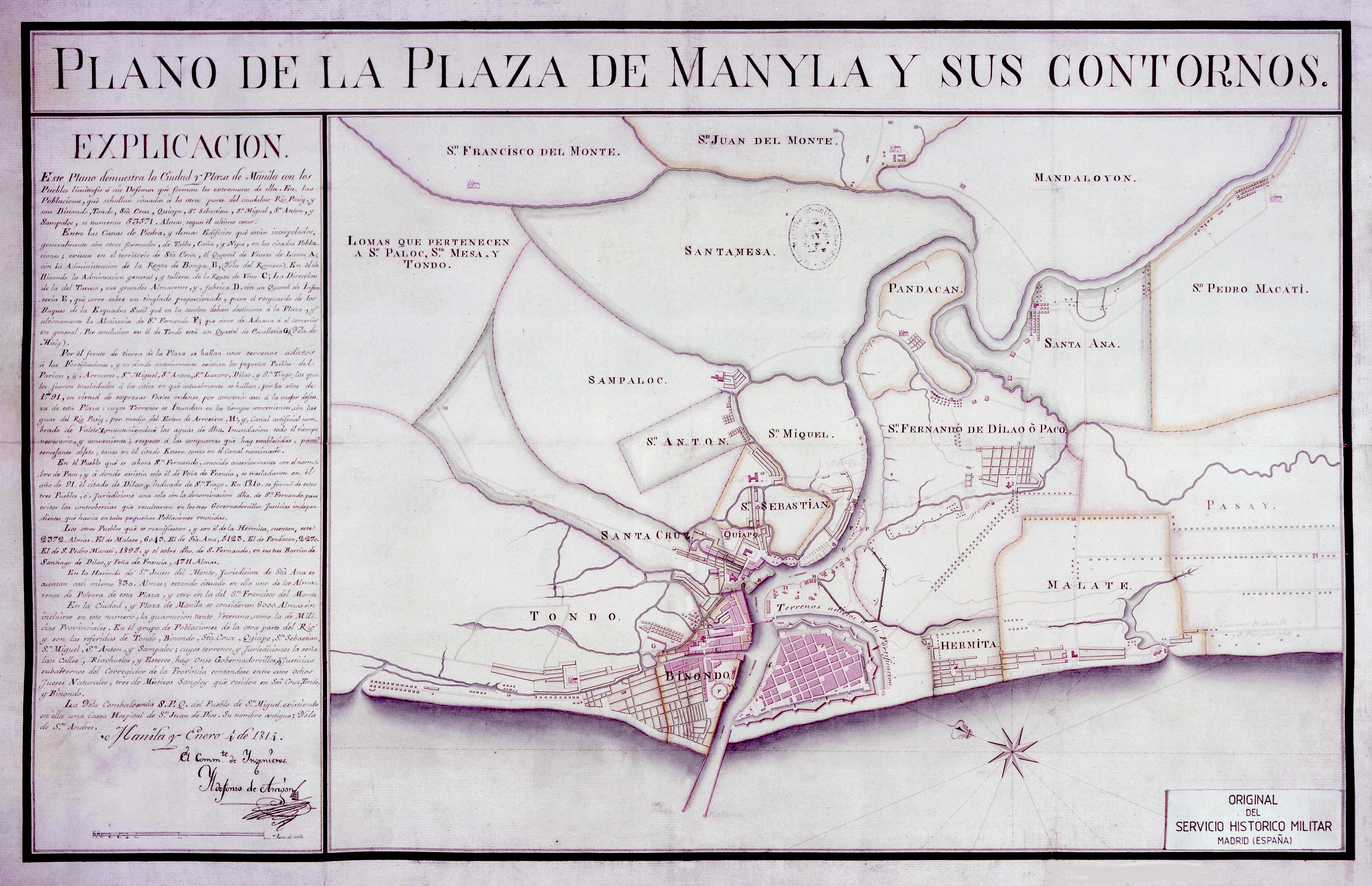
Old Map of Manila
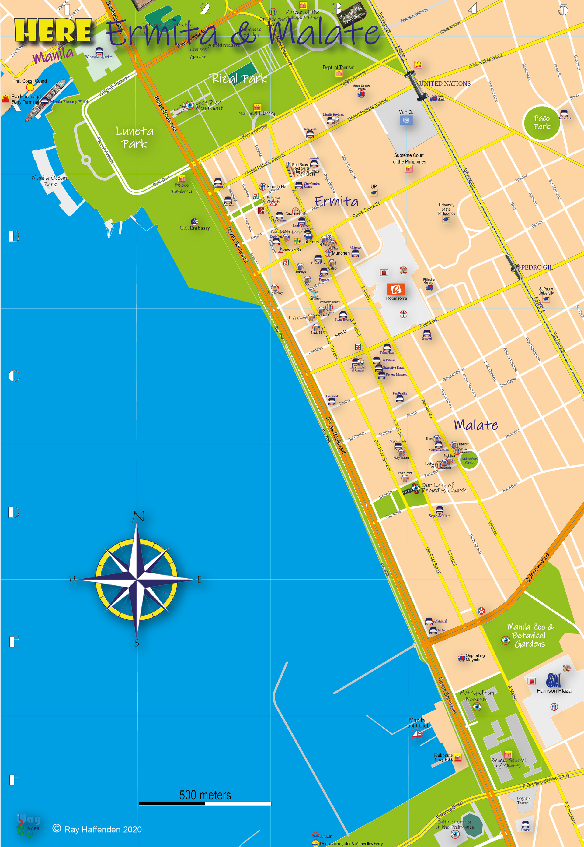
Ermita & Malate